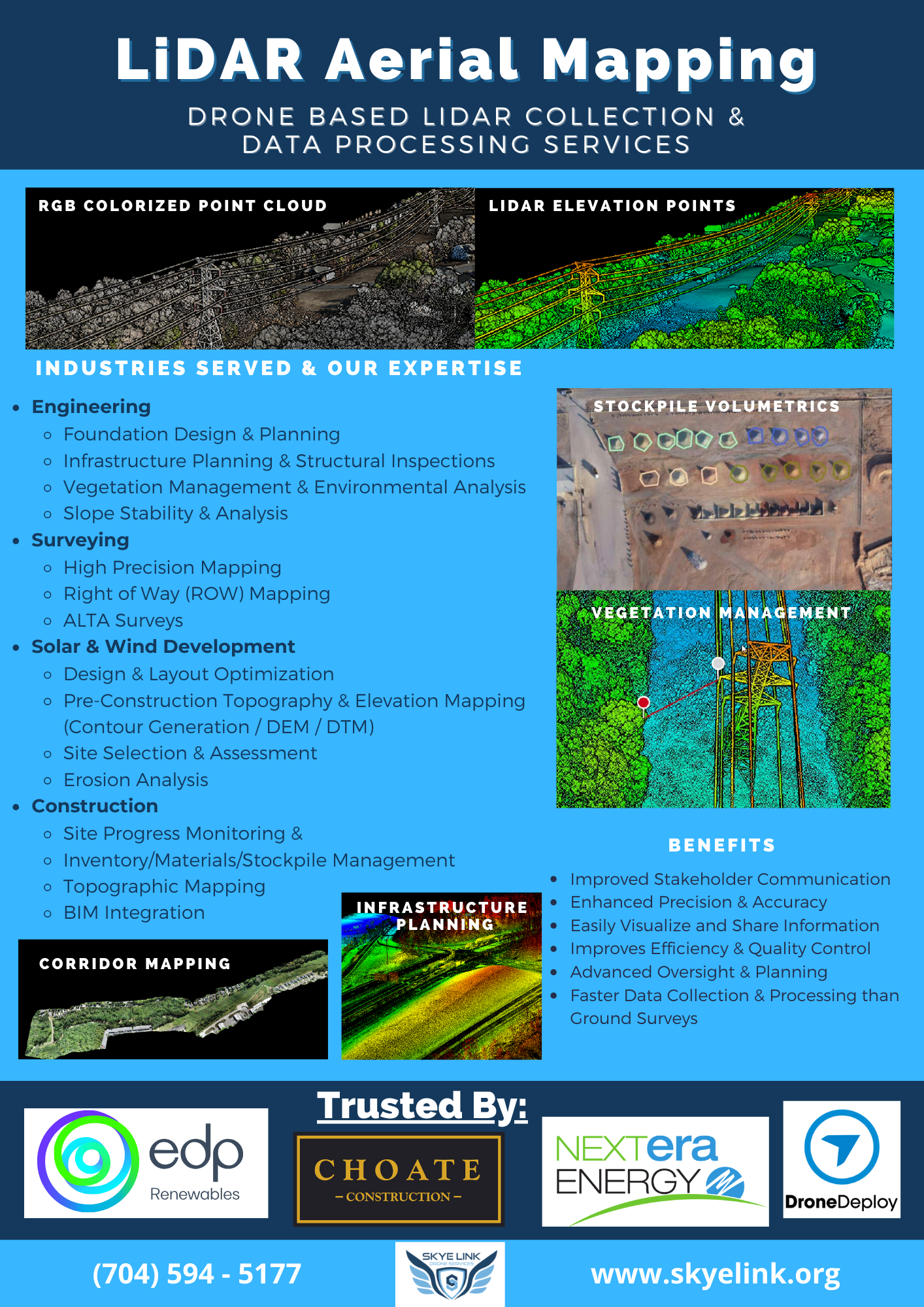
Drone LiDAR Mapping Survey Data Solutions: Precision-Driven Aerial Surveying
Drone LiDAR Mapping & survey solutions

National Drone LiDAR & Aerial Surveying Data Solutions

For surveying firms specializing in land surveying, geospatial analysis, cadastral surveying, and land development, drone-based LiDAR technology offers specific advantages tailored to their expertise. Skye Link Drone Services is ready and support the following drone lidar and aerial surveying use cases on a national basis:

  1. High-Precision Aerial Surveying:
    • Boundary Determination: LiDAR-equipped drones provide accurate elevation and terrain data crucial for precisely determining property boundaries, aiding in cadastral surveying.
    • Land Development Planning: Detailed topographic mapping assists in land development projects by providing precise information for design and planning.
  2. Detailed Mapping and Analysis:
    • Cadastral Surveys: Drone based LiDAR technology enables accurate cadastral surveys by offering detailed 3D models and elevation data, improving cadastral mapping accuracy.
    • Geospatial Analysis: Precise LiDAR-derived elevation models support detailed geospatial analysis, aiding in environmental impact assessments and land use planning.
  3. Efficient Data Collection:
    • Rapid Surveys: Drones equipped with LiDAR sensors can quickly collect vast amounts of highly accurate data, reducing surveying time and costs compared to traditional methods.
    • Remote and Inaccessible Areas: Drone LiDAR can access and survey remote or hard-to-reach areas, providing valuable data without the need for extensive ground access.
  4. Enhanced Mapping Capabilities:
    • 3D Visualization: Aerial LiDAR data facilitates the creation of detailed 3D models and point clouds, providing a comprehensive view of surveyed areas for better analysis and decision-making.
    • Topographic Mapping: Detailed elevation models and contour maps aid in landform analysis, volume calculations, and precise mapping of terrains.
  5. Land Development Optimization:
    • Infrastructure Planning: Accurate mapping assists in optimizing infrastructure layout, including roads, utilities, and drainage systems, ensuring efficient land development.
Drone lidar digital terrain model example

For surveying firms, drone-based LiDAR technology significantly enhances their capabilities by providing highly accurate and detailed spatial data for property surveys, land development planning, environmental assessments, and geospatial analysis.

The efficiency, precision, and comprehensive data outputs of LiDAR mapping align well with the needs of these firms in delivering accurate surveying and mapping services.

With Skye Link’s national reach, we are able to help partners & clients scale their operations nationally in a cost effective way without compromising data quality. 

Key Advantages of Aerial Drone LiDAR Mapping for Surveying

    1. High Precision: Offers extremely accurate and detailed data capture.
    2. Efficiency: Enables rapid data collection and processing compared to traditional methods.
    3. Cost-Effectiveness: Reduces operational costs and time spent on surveys and inspections.
    4. Safety: Minimizes risks associated with manual inspections in hazardous or hard-to-reach areas.

Request Quote For Drone LiDAR Mapping & Aerial Surveys

Why Skye Link? We are a national drone service company providing aerial data solutions for surveyors & surveying companies. Our turnkey managed drone services streamlines aerial drone mapping including high-precision aerial surveying, aerial LiDAR corridor mapping for vegetation management, As-built & ALTA Surveys, land development planning, cadastral surveys, topographic & elevation modeling, and much more!

Interested in Learning More? Let’s Connect!

Talk to our professional team to get your questions answered and begin utilizing the power of drones and aerial data to effectively enhance your mapping capabilities!

Lidar aerial mapping


    Disclaimer: Skye Link is an aerial data collection company only. We are not licensed surveyors and only provide aerial data collection services to surveyors and surveying compnaies to utilize drone data for their surveying services. Additonally, if a client requests an aerial survey from Skye Link, we subcontract a professional licensed surveyor in the state of the project to conduct all related survey scope items to abide by local, state and federal laws and regulations.